Route Description
Lady Anne's Way is a 100 mile trail leading from Skipton in North Yorkshire to Penrith in Cumbria. The walk was devised to follow some of the routes Lady Anne Clifford took while travelling between her castles, and also to walk through the beautiful scenery of the Yorkshire Dales and Eden Valley. The route is one of great beauty, outstanding scenery and historical interest. The following is to provide further information about the route. Please note that all distances and heights are approximate and along with all the other information are provided as an aid to describe the route.
Terrain
The terrain varies from riverside paths, farmland, country lanes and lowland moors.
Waymarking and Navigation
The route is not waymarked but it follows recognised footpaths. We recommend you are able to navigate with Ordnance Survey maps and a compass. A GPS is also a good backup device.
Skipton (height above sea level 140m) to Grassington (200m). Distance 15 miles.
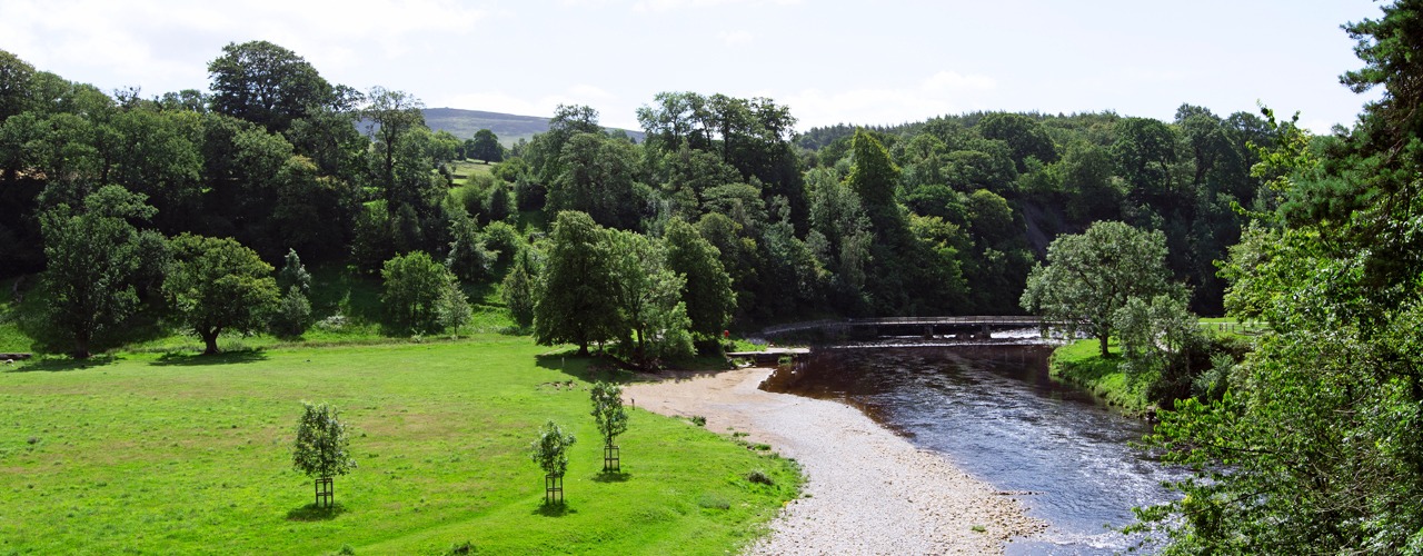
Lady Anne Clifford was born at Skipton Castle, now one of the best preserved medieval castles in England and fittingly the route begins at her birthplace. Skipton is known as the gateway to the Dales and has lots to offer, with cobbled streets and alleyways to explore, with plenty of shops and cafes to visit. Skipton castle is also worth a visit. After leaving Skipton, the first village on route is Embsay, famous for its steam railway. You continue across farmland and enter the Yorkshire Dales National Park. The next 50 miles of the Lady Anne’s Way are within the Yorkshire Dales, there is such variety to be discovered, lonely fells, idyllic riverside graze land, leafy woods, farmland and pretty villages with an interesting industrial past. The path climbs onto moorland and crosses Halton Edge (290m) before descending to the ruins of Barden Tower where Lady Anne often stayed throughout her life. The route then follows the banks of the River Wharfe to the picturesque, unspoilt village of Burnsall (150m). The route leaves the river to cross fields to Hebden and then Grassington. Grassington is a small, thriving town. It attracts many visitors with its cobbled streets and attractive buildings and once prospered from the lead- mining industry.
Grassington (200m) to Buckden (220m). Distance 13 miles.
From Grassington you walk uphill to Capplestone Gate (512m) on Conistone Moor with vast views of Wharfedale, Bastow wood and Lea green. After the uphill trek it’s a gradual walk downhill to delightful Kettlewell (210m) which has a few shops and pubs. The route continues through fields to Starbotton, before following the River Wharfe to Buckden.
Buckden (220m) to Hawes (240m). Distance 18 miles.
From Buckden the path climbs to the top of Stake Moss (558m) to a route once used by the Romans, and Lady Anne herself to visit her castles in the Eden Valley. The path is easy to follow and descends gradually to join a bridleway and a clear track to Cubeck and from there to Worton (200m). From Worton it’s on to Nappa Hall, a well preserved medieval building, where Lady Anne stayed one night. Other famous visitors include James 1, Sir Walter Raleigh and Mary Queen of Scots. Then it’s onward to Askrigg with shops, cafés restaurants. The painter Turner stayed at the King’s Arms and in the market place there is a commemorative seat for the travels he undertook in the 19th century, it is known as the Turner trail seat. Also, Crinkley House in Askrigg (230m) was frequently used in the television series ‘All Creatures great & small’. From Askrigg the walk takes you along Wensleydale valley. It is worth visiting Mill Gill falls, a few yards off route the waterfalls are a sight to see. Then it’s onward across fields to Hawes, a busy market town in Upper Wensleydale with lots of visitor attractions, cafes and shops.
Hawes (240m) to Kirkby Stephen (180m). Distance 17 miles.
From Hawes there is a walk through fields to Appersett viaduct. You follow the River Ure to the ‘Highway’, where the path climbs to take this ancient high route over the fells from Wensleydale to Mallerstang valley. The Highway (highest point 500m) was used by the Romans. In the 18th century it was a packhorse route for goods from Wensleydale to Kendal and was also used by Lady Anne on her way to Pendragon Castle. There are superb views all around as a reward. While on the Highway there are deserted buildings to see, one being High Hall. The next point is to Hell Gill Bridge; look over the right side at its steep sided ravine. It is believed a highwayman on horseback jumped this gully to escape capture. The bridge also denotes the border between Cumbria and Yorkshire. The Highway descends, at the valley bottom, there is a sculpture called ‘Water cut’ by Mary Bourne and is known as the Eden Benchmarks. It is one of ten commissioned by East Cumbria Countryside Project. The route follows the river to Outhgill (250m) and Pendragon Castle. Locally it is believed the castle was built by Uther Pendragon, father of Arthur of the round table. Lady Anne restored the castle in 1660 and was a useful stopping point for her on the way to her castles in the Eden Valley. From the castle the route continues to Nateby village from where it’s a short walk to the market town of Kirkby Stephen.
Kirkby Stephen (180m) to Appleby-in-Westmorland (150m). Distance 17 miles.
This section offers wonderful scenery and is steep with historical interest, with the ruins of Brough Castle, Ormside ‘Cross’ and church, ending in Appleby with its magnificent castle and churches. The path follows the river downstream, to your right there are views of Nine Standards Rigg in the skyline, then across fields to the outskirts of Winton village. Shortly after Winton you leave the valley of Mallerstang to begin your journey through the lovely Eden Valley. Passing the hamlet of Kaber, walk along Belah River with views to the red cliffs of Belah Scar. The next village is Brough Sowerby then to Church Brough (180m), where you can wander off route to visit the castle remains. Lady Anne’s Way takes you through the centre of Church Brough then through some fields to follow a good path, contouring Langrigg Hill to Flitholme. There is the option to visit Warcop village or continue along Lady Annes Way to Warcop Old Bridge. The track takes you along bridleways, hedge lined paths, riverbanks, and farmland to Little Ormside and Great Ormside. The church of St James in Great Ormside is rich in history and worth visiting if time allows. There is easy walking alongside the River Eden to Appleby. The castle restored by Lady Anne is now privately owned and is therefore not open to the public. However there is still plenty to see in Appleby and wherever you go there are references to Lady Anne. The church of St Lawrence holds the elaborate tomb of Lady Anne and her mother Margaret Countess of Cumberland. Appleby is extremely busy in early June with travellers and horse traders, it holds the biggest horse fair of its kind in the world.
Appleby-in-Westmorland (150m) to Penrith (140m). Distance 20 miles.
This section is a low level route with splendid views, delightful villages and ancient ruins of Brougham Hall and Brougham Castle, just before reaching Penrith and the end of the trail. On leaving Appleby you continue through fields to the delightful village of Long Marton (130m). The church here was built in the 12th century on the site of an earlier wooden structure. Leaving the village it’s onward to Kirkby Thore, where there is the hall of medieval origin and a site of a Roman Fort. From here the path follows the River Eden to Ousenstand Bridge (100m) then continues to Crossrigg Hall, built in 1864 to a Jacobean design and retains some of its original features. It’s then Cliburn with its church standing in a prominent position above the River Leith. After Cliburn there is a section of road walking with a good grass verge if you prefer, with Whinfell Forest to your right. Then it is onwards to Pembroke House and then Brougham Hall. The ruins of Brougham hall are undergoing restoration. In the stables and carriage houses there is a craft fair and a café. From Brougham Hall your next landmark is Brougham castle. The castle is an extensive ruin and was built by Robert de Vipont one of Lady Anne’s ancestors. Lady Anne spent a lot of time here, her father was born here and both she and her mother died here. From the castle it’s a short walk to Penrith. In the centre of town is the market square, with a monument and clock tower marking the end of Lady Anne’s Way.
More Information?
For more information or to make an enquiry, please don't hesitate to call or email us.


